| Route 31 | Coventry Parkway |
|---|---|
| Maintained by | Ianistan Department of Transportation |
| Length | 10.5 miles |
| Existed | 1917-present |
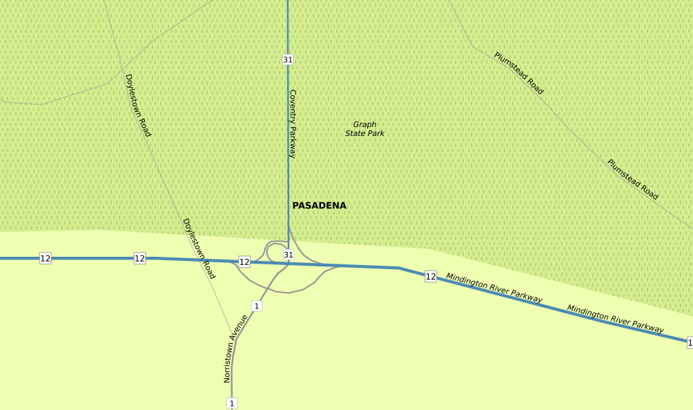
| South End: | Route 1 and Route 12 in Pasadena |
| Major Junctions: | |
| East End: | Route 14 in Eyersburg |
| Location: |
Route 31, the Coventry Parkway, is a secondary north-south route through Graph State Park. It, along with Route 14, serves as a scenic route between Pasadena and White Sky. The parkway is one of a few in Ianistan which fully restricts trucks.
Pasadena[]
Route 31's southern terminus at Route 1 and Route 12 in Pasadena
The Coventry Parkway and Route 31 begin at the interchange of Route 1 and Route 12 in northern Pasadena, where Route 1 North joins Route 12 West (and Route 1 South leaves Route 12 East) and heads to Brightland International Airport. Route 31 immediately enters Graph State Park, as the main route through the park.
Route 31 continues on a straight path, as a two-lane undivided road with a 50 MPH speed limit through the rest of Pasadena.
Broughton and Eyersburg[]
Route 31 curves and meets with the Ianistan Turnpike Rhineland Extension, at its Exit 11, marked as the Graph State Park interchange. After this interchange, Route 31 becomes a two-lane road with a center left turn lane and a 45 MPH speed limit.
The road then curves around Broughton, serving its eastern side to its west and serving Graph State Park to its east. The TheTA Mountain Line closely parallels Route 31 for the rest of its length.
Upon entering Eyersburg, Route 31 terminates at Route 14, where turning left places traffic on Route 14 West (Scotland Road), continuing straight places traffic on Route 14 East (Coventry Parkway), and turning right places trafrfic on Scotland Road East.